|
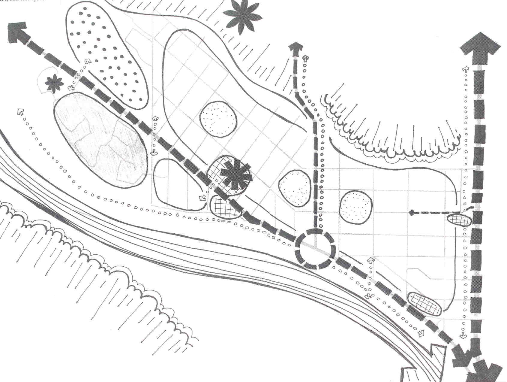
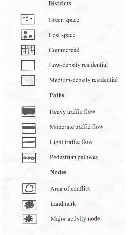
In our analysis of the spatial structure of Parkdale, we used
five aspect to held up understand the context of the community.
Landmarks (prominent points which are
highly visible)
 |
The Foothills Hospital |
|
McKay Pointe Towers |
|
The Bow River |
|
The escarpments of the river valley |
Districts (patterns of land use)
|
Two major districts are residential and
institutional |
|
Within these two there are commercial, low
and medium density residential, green space and lost space |
Edges
|
Parkdale is framed by some escarpments to the
north and south. These form natural edges and major roadways make
boundaries to the east and west |
Nodes (focal points)
|
Parkdale Crescent is a busy commercial node
along with some other ones |
|
A major transportation node is at the
intersection of 29th Ave and Parkdale Boulevard. |
Paths
|
Major roads that serves as pathways are like
Crowchild Trail, 29th Ave, Parkdale Boulevard and some other roads |
|
The bike path along the Bow River is an
important pedestrian path within the community |
|