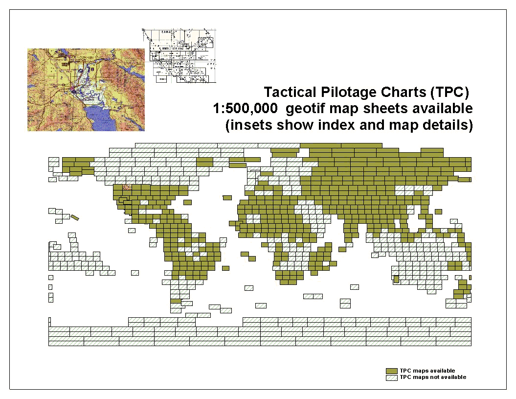
Tactical Pilotage Charts506 US military 1:500,000 scaleTPCs (Tactical Pilotage Charts: scanned topographic/aeronautical maps) GeoTiff file format Geo WGS84 |
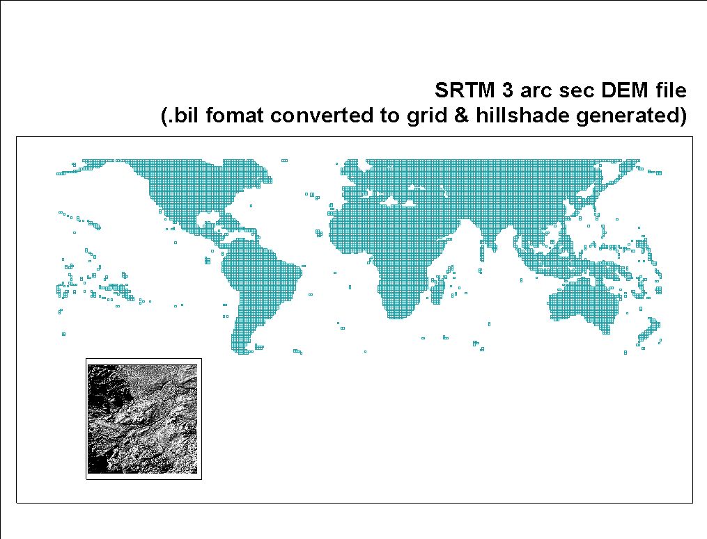
3 arc second (approx. 90m)Shuttle Radar Topography Mission (SRTM) / DEMcovers the World from Latitude 57 South - 61 North.bil file format, Geo WGS84 (also includes hydrology vectors used for editing of the DEM data) |
30 arc seconds (approx. 1km)Shuttle Radar Topography Mission (SRTM) / DEMglobal DEM made from SRTM and GTOPO30 |
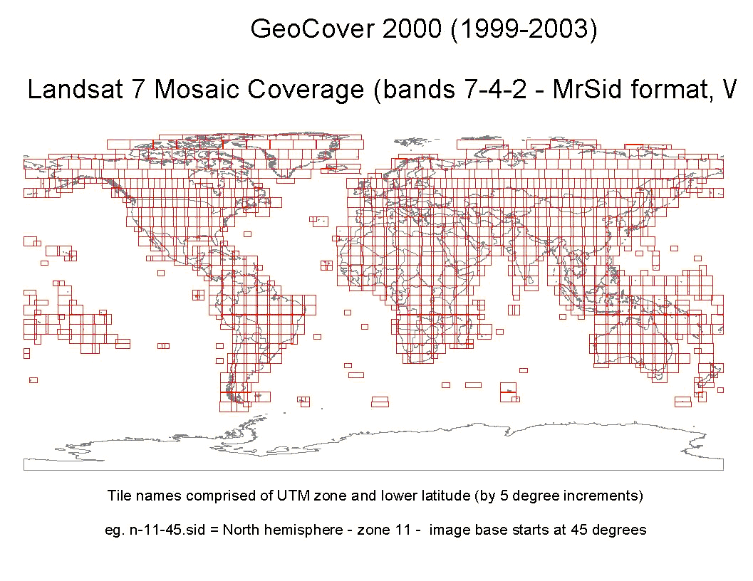
GeoCover 2000 (1999 - 2003)Landsat 7 ETM15m, bandsworldwide satellite imagery MrSID wavelett compressed file UTM WGS84 |
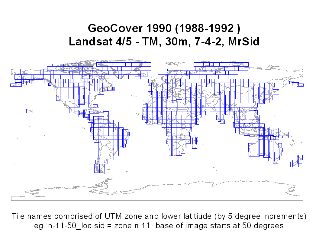
GeoCover 1990 (1988 - 1999)Landsat 4/5 TM30m, bandsMrSID wavelett compressed file format UTM WGS84 |
VMAP0 worldwide1:1,000,000 scale vector data(near-worldwide coverage, varies by layer), ESRI .shp and MapInfo .TAB file formats Geo WGS84 |
Data LicenseAll data is
free of license restrictions with the exception of the 1:500,000 which
are the
copyrighted property of LAND
INFO Worldwide Mapping, LLC and are
subjected to
the Any use or
duplication of TPC content without a license, or contrary to license
terms,
violates copyright law and is expressly prohibited.
|
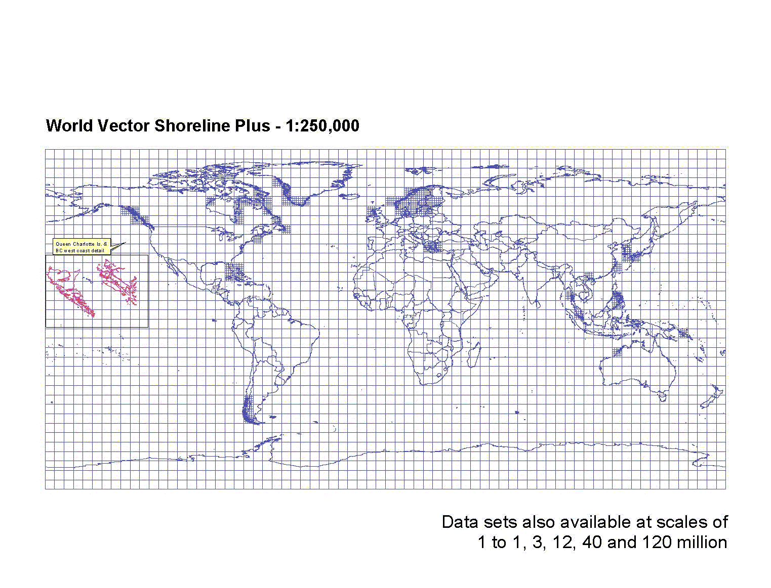
World Vector Shoreline PlusVector data of the World's coastlines andninternational borders/boundariesat various scales from 1:250,000 to 1:120,000,000 ESRI .shp file format Geo WGS84 |
MADGICInquire at our Reference Desk(Maps, Academic Data & Geographic Information Centre) 2nd Floor, MacKimmie Library Tower Libraries and Cultural Resources University of Calgary Open Monday-Friday, 10:00-4:30 |